After a sweltering heatwave that hiked temperatures into the high 90’s and low 100’s in portions of Colorado over the Labor Day Weekend, Canadian air surging south through the Plains, Rockies, Intermountain West, and West and is setting the stage for a significant snowstorm that could bring up to or over 2′ of snow to some areas.
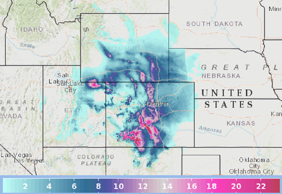
The potent cold front from Canada is causing temperatures to significantly cool down, as well as spread snow across the Northern and Central Rockies. Several locations could accumulate amounts of 6″+, with 1-2′ possible in the highest peaks. With heavy snow on the way, the National Weather Service has issued Winter Storm Warnings and Weather Advisories throughout portions of the Rockies from southern Montana to southern Colorado. Freeze Warnings, Frost Advisories and Freeze Watches are also in effect across western Montana, northern Idaho, eastern Colorado, western Nebraska, North Dakota and northern Minnesota, with a very early ending to the growing season possible in many areas.

While this set-up will produce cold and snow over the Rockies, it will also set-up dangerous high-speed, dry winds over the West, which will exacerbate the threat of rapidly spreading wildfires in the region from the Canadian border south to the Mexican border. Due to that threat, the National Weather Service has put a huge area under a Red Flag Warning due to fire weather conditions. A Red Flag Warning means that critical fire weather conditions are either occurring now or will shortly. A combination of strong winds, low relative humidity, and warm temperatures can contribute to extreme fire behavior.
